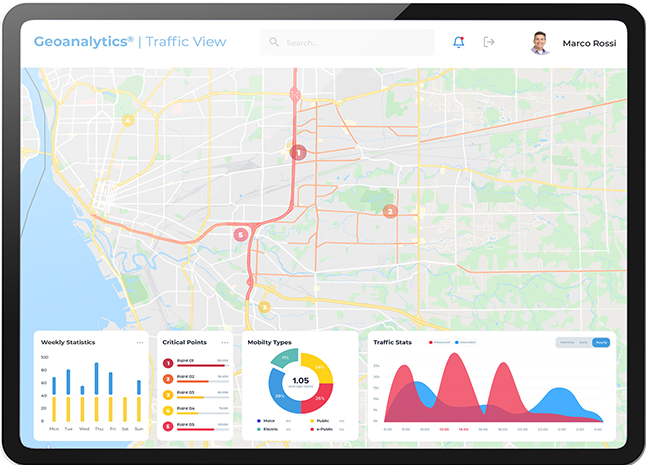
WiseTown GeoAnalytics is a Decision Support System available to city administrators and public administration professionals. Maps, graphs, infographics and statistics highlight valuable information and provide an extrapolation of complex information useful for more informed urban planning.
WiseTown GeoAnalytics is a digital platform based on customized dashboards and integrates data collected by IoT sensors, GIS (Geographical Information System) data, information from city portals and various applications to create a tool to support city intervention strategies.
The DSS platform (Decision Support System) is able to analyze city data and show correlations between different phenomena, thanks to the use of included cartographic maps and the possibility of superimposing information from different information streams.
Maps, graphs, infographics and statistics highlight valuable information and provide an extrapolation of complex information useful for more informed urban planning.
A Decision Support System is designed to enhance the work of decision-makers and enable them to make informed, measured, data-driven decisions, facilitating the identification of the issue and making it possible to predict and measure the impact of their actions. Otherwise, cities are left without effective and productive action planning, which means wasting time and resources.
Public Administration, Cities, Energy Utilities, Smart Water, Public Safety Industries, Natural Resource Management